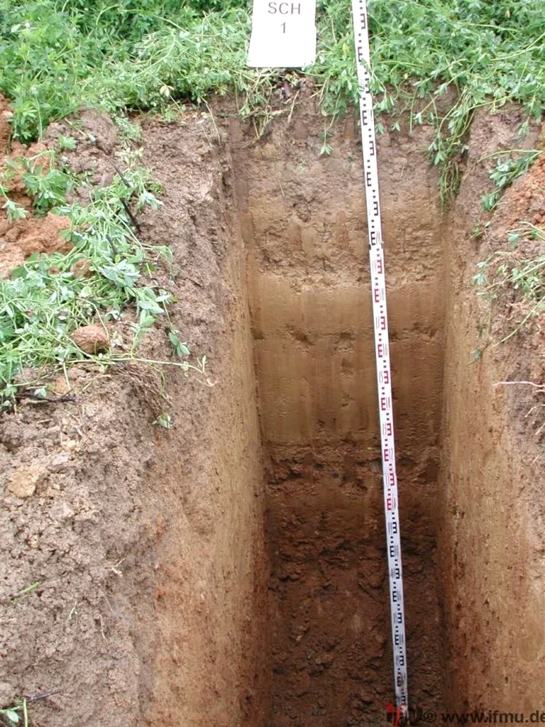
The Fraser Valley doesn't hide its geology quietly. In Chilliwack, perched on a deep alluvial fan where the Vedder River once braided across the entire plain, what you see at surface rarely tells the whole story. We've opened test pits near the Fraser floodplain and found clean gravels sitting directly on compressible silts — a layering sequence that slab-on-grade contractors need to see with their own eyes before placing fill. An exploratory test pit gives you that visual certainty in about half a day. For projects around the Eastern Hillsides or along Luckakuck Way, where glacial till can transition to outwash sands within a single lot, we often combine the pit investigation with a grain-size analysis to confirm the fines content before the structural engineer locks in the bearing design. The value here is speed and visibility — no lab turnaround required for the primary observations, just a detailed field log backed by calibrated sampling protocols.
A one-day exploratory pit program in Chilliwack typically delivers two to three logged exposures, enough to bracket the soil variability across a typical residential lot.
Site-specific factors
Chilliwack sits in a seismic zone where the NBCC 2020 assigns a peak ground acceleration of 0.37g on Site Class C — and when you're on Site Class D or E soils, that acceleration amplifies. Skipping direct visual verification of the soil profile means you're guessing at the site class, which cascades into conservative (and expensive) structural design or, worse, an unconservative one. We've excavated pits in the downtown corridor where buried organic horizons — old slough channels from the Vedder's historical migration — showed up at 2.3 metres depth. That kind of compressible layer, if missed, leads to differential settlement under strip footings within the first wet season. The pit also reveals the actual depth to competent bearing: on the Yarrow side of town, we've seen competent gravel at 0.6 metres in one corner of a lot and at 2.8 metres in the opposite corner, just 40 metres away. Without that visual transect, the foundation design is working from an average that doesn't exist.
Frequently asked questions
How much does an exploratory test pit program cost in Chilliwack?
A typical test pit investigation in Chilliwack — covering mobilisation of a rubber-tired excavator, two or three pits logged to 3 to 4 metres depth, field documentation, and a summary report — falls in the range of CA$650 to CA$1,260. The spread accounts for access constraints, pit depth, and whether we're coordinating lab testing on the same mobilisation. Tight backyard access or sites out toward the Vedder Mountain flank can push toward the upper end because of machine size restrictions.
How long does it take to get results from a test pit investigation?
The field observations are available immediately — you can stand beside the pit and see the profile while we log it. We typically deliver the draft field log and photo record within two business days. If lab testing on collected samples is required (grain size, Atterberg, moisture content), those results follow the lab's turnaround, usually five to seven working days. The final summary report integrates field and lab data and is issued within a week of receiving the lab results.
Can you dig test pits in clay soils during Chilliwack's wet winter months?
Yes, but the approach changes. Between November and March, the water table rises across the Fraser lowlands and pit stability in saturated clay or silt becomes a real safety consideration. We batter the pit walls back to a safe slope or use a trench box if we're entering the excavation. Groundwater seepage can obscure the face within an hour, so we clean and log immediately after excavation. The log will note the seepage depth and any softening of the floor — information that's actually valuable for the drainage design.